MAY 12, 2020 VIRGINIA BEACH, VIRGINIA
Osprey Nesting Identification Map
Lynnhaven River NOW is excited to share a new and interactive map that marks osprey nesting sites along 64th Street at the Narrows in First Landing State Park.
Last summer, LRNow’s Discover Virginia Beach Program Coordinator Terri Gorman hosted an osprey walk at the Narrows with raptor expert Reese Lukei and Robert Brown, LRNow volunteer, photographer and osprey enthusiast.
Moved by these beautiful birds, Terri patiently awaited the ospreys’ return from points south to the Narrows this Spring to observe the big ospreys as they waited for their mates and began to rebuild their nests. “I think this is most exciting time to watch them and I am hoping others will be fascinated and take interest in osprey” Terri said.
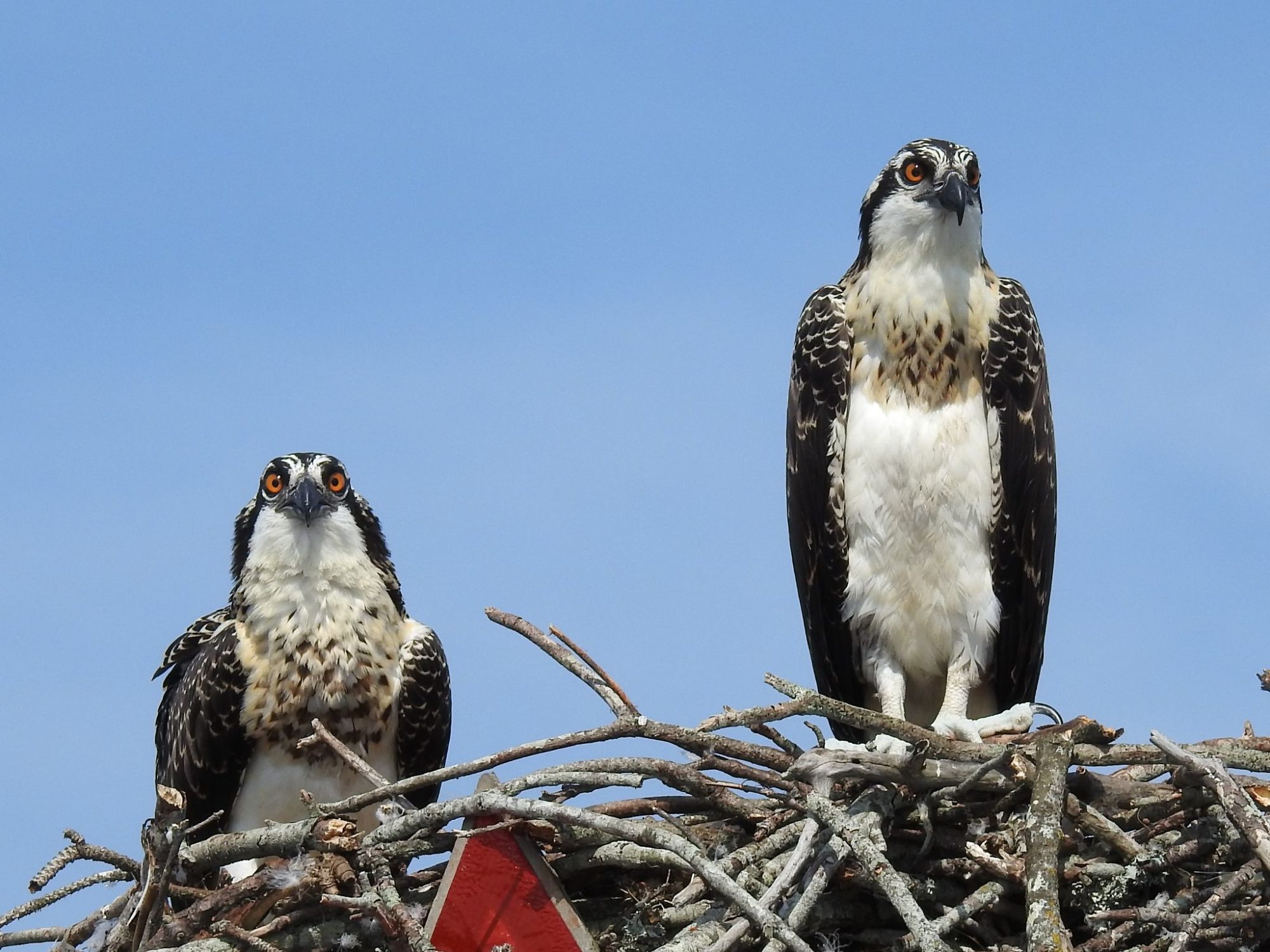
Terri hopes her interactive osprey map will provide a way for people to walk in the park and observe osprey nests on foot rather than by boat on the water where the majority of osprey nests are found. The Narrows is a unique area where ospreys still nest in trees and not on manmade platforms and buoys on the Lynnhaven River.
Robert, a dedicated LRNow volunteer, has been an enormous help with this project. He has been photographing, observing and collecting data on the osprey for years and has christened each nest with a colorful or apt name. Robert has provided all his data for Terri to use on the interactive map.
His photos show the sizes and shapes of the nests and trees, which is helpful when tying each individual nest to its name and GPS coordinate. That way, osprey watchers can keep their eyes on specific nests, watch to see that the moms are sitting on eggs and look for baby ospreys when they are born.
Please send any photos or observations to office@LRNow.org
>> Osprey Nesting Map Link
Please Note: the platform used to create this map is Google Earth. You can download the Google Earth App for free on your mobile device or access through your google chrome browser.
Together, we can make a difference.