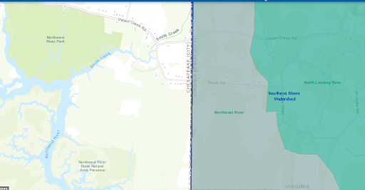
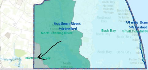
Location
- Far southwest corner of the city.
Size (shoreline and acreage drained)
- 2,142 acres, 1.1% of city
- Total watershed is 140,00 acres in VA and NC
- Discharges into Currituck Sound
- Only 1% is in VB
Population Density
- Least populated.
- Very low population density.
Land Use (urban/rural)
- The Northwest River Watershed is not heavily developed.
- Of its 66,437 acres, less than one percent of the area, 3,554 acres, is in residential or commercial development.
- Farming and agriculture use about twenty-five percent of the area, or 16,527 acres.
- The remaining 46,356 acres is either wetlands or unmanaged forest lands.
% Owned by State or Federal
Names of Federal or State properties
Major Bodies of Water and Salinity
- Northwest River-primary water supply for the city of Chesapeake.
- Mostly freshwater, dependent on wind tides.
Recreation Areas (access points, natural areas, parks)
- Northwest River Park in Chesapeake.
- Several sites along Indian Creek Road off Battlefield Blvd. South
Plants
- Listed along with North Landing River and Back Bay as having the highest concentration of rare plants and animal species east of the Blue Ridge Mtn.
- Old mans beard
- Grey green fungi
Urban Tree Canopy
- Scattered examples of mature upland forest
Wetlands
- Non-riverine swamp forest
- Water tupelo/bald cypress swamp
- Tidal shrub swamp
- Marshes
Animals
- Important wildlife corridor, linking the Dismal Swamp to Back Bay and North Landing River Preserve.
- Largemouth bass
- Chain pickerel
- Blue catfish
- Yellow perch
- Canebrake rattlesnake- endangered
- Frequented by black bears
Soil Characteristics
- Wetland soils.
- Western part has good farming soil.
Threats
- Climate Change over time will create the possibility of ghost forests in the future.
- Landward movement of marshes/swamps.
History
- The North Landing River was originally called the North River. The Northwest River was named to differentiate from the North River.
- The settlers that settled this watershed were from North Carolina, coming up from the Albemarle Sound.
- Currituck Inlet was open to the Ocean across from Knotts Island and there is commerce into the southern part of Virginia Beach (then known as Princess Anne County)
- Civil War and the advent of the RR and the canals connected this part with the rest of VB
- Cypress tree logging for shake singles and fence pickets
Misc.
- Part of the Albemarle/Pamlico watershed.
- Majority of the watershed is in Chesapeake.

Do you live in the Northwest River Watershed? Order your FREE sticker today! Email Office@LRNow.org
Don’t know which watershed you live in? Click HERE to discover your watershed.